
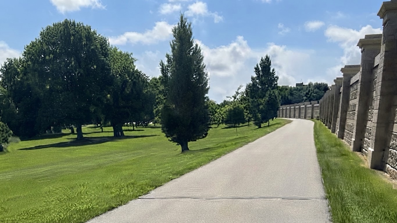

The Grand Forks Greenway is about 20 miles of trail running along both sides of the Red River. The land between the new flood walls and the river can never hold houses again, so it got trails, parks and disc golf courses instead. The whole flood protection project cost $409 million, and $22 million of that was set aside for recreation. That is the part most people out there walking do not know. The Greenway is not a park somebody dreamed up. It is what the flood left behind.
What is under the trail
The numbers are on the City of Grand Forks flood protection page and they are worth sitting with for a second.
Eight hundred fifty properties went through the voluntary buyout program in 1997 and 1998. Six hundred ninety four homes were demolished, along with 493 other structures. Another 161 houses were not destroyed, they were picked up and moved somewhere else, which means there are houses being lived in around this area right now that used to sit where you walk your dog.
Two neighborhoods took almost all of it. Lincoln Drive on the Grand Forks side, and Sherlock Park across the river in East Grand Forks. If you want to understand how differently those two towns handled the years after, that is most of what I got into when I wrote about what actually changes when you cross the river between Grand Forks and East Grand Forks.
The river crested at 54.35 feet on April 22, 1997, at the gage between the two downtowns, according to the National Weather Service survey of the flood. Then came eight miles of levee and floodwall on the Grand Forks side, and everything on the wet side of that line became the Greenway.
What you can still see if you know to look
The craziest stretch of the whole Greenway is Lincoln Drive Park. I live downtown, so I catch the greenway off Eighth Ave N. on my daily walks, but if you want to actually understand what the buyout did, Lincoln Drive Park is where you go.
There was a neighborhood there. Nearly 350 homes, going back to 1882, with a dairy farm, an ice harvesting business, and even a ski jump in its history. All of that is on a marker the Greenway put up on Euclid Avenue, and it is worth standing there and reading the whole thing.
The part that gets me is that the neighborhood already knew. A levee and a concrete floodwall went up in 1956, and people still had to sandbag when the water came up. Forty years of spring sandbagging, and in 1997 the river took all 350 houses anyway.
Here is what is still on the ground. The road you drive in on to reach the dog park was Lanark Street. The dog park itself sits where Lanark met Lincoln Drive. One of the disc golf baskets is planted on what used to be Omega Avenue. People figured that out by laying old Sanborn insurance maps and a 1994 USGS map over the park as it sits today.
And then there are the trees. Along the park road, and standing out in open mown grass where no tree has any business being, you will see big mature trees running in straight lines. Nothing in nature lines up like that. Those are boulevard trees. They were planted along sidewalks, the sidewalks ran past front yards, and the front yards belonged to 350 houses that are not there anymore. Ghost tree lines. The houses came down, the streets went under grass, and the trees just kept standing exactly where somebody put them.
You are not walking through a park that happens to have nice old trees. You are walking down Lanark Street.
Three stairs
My parents and I got evacuated, somewhere around April 19th, I left for the Air Force and had my first day of basic training on May 29th. That was rough to leave that soon after everything went down and I am sure I could have delayed it, but it ended up being the best decision of my and my path was laid out for me.
My parent’s house sits a little raised. You walk in the back door and you are on ground level, but the main floor is up three stairs from there. When we got to go back in and look, the basement was still full of water, and the line on the wall had stopped right at the bottom of that top stair.
Three stairs. That is the entire difference between my parents losing the house and my parents still living in it today, which they do, almost thirty years later.
Nobody picked that house because of how it sat. You do not think about those three stairs mattering until the one week you do.
The best walk in Grand Forks, and hardly anybody is on it
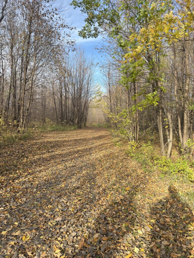
Here is what I actually do with it now.
I drop in off Eighth Avenue North and head either toward downtown or out toward Riverside Park. The paved path is great and plenty of people are on it. But the part I like is getting all the way down close to the river and walking the trails in the trees, the ones the snowmobiles run in winter. Most people have no idea those are down in there.
Fall is the best time to walk it and it is not close. Sun is out, trees are turning, air is crisp and cool. You have got the river on one side of you and the city on the other side of the flood wall, and you can hear both of them. It is like being in the woods in the middle of a city.
That is the whole thing right there. No real estate angle, no point to make. Twenty miles of trail, and on a good October evening you will have long stretches of it to yourself.
If you are looking at a house near the Grand Forks Greenway
Living a block off the Greenway is one of the genuinely great things you can buy in this town. Trail out your back door, and nobody can ever build on that view, because the reason the land is open is the reason it has to stay open.
That said, these are the river neighborhoods, so there are things to actually check instead of assume:
- Which side of the protection the house sits on. Verify with the city, not with a neighbor and not with me guessing.
- The flood zone determination for that specific address, which drives whether your lender requires flood insurance.
- Drain tile, sump pump, and whether the sump has backup power. The 1997 lesson was that water comes from underneath.
- Whether sewer backup coverage is on the policy, because it usually is not included and it is cheap to add.
None of that is a reason to avoid the area. It is a reason to ask four questions before you write an offer. The home buyer guide walks the whole process including where these checks land in the timeline, and if you want to know what homes in these neighborhoods are actually selling for right now, I keep that current on the Grand Forks housing market page.
Questions I get about the river
What happened to all the houses that were bought out after 1997?
Eight hundred fifty properties went through the voluntary buyout program in 1997 and 1998. Most were demolished, 694 homes in total. About 161 houses were physically moved to other lots instead of torn down. The cleared land became the Greenway, because it sits on the wet side of the new levee system and cannot be built on again.
Do I need flood insurance in Grand Forks?
It depends entirely on the specific address, not on the city. Your lender requires it if the property sits in a mapped high risk zone. Plenty of homes here are not in one, and plenty of people outside those zones carry it anyway because it is inexpensive there. Get the determination for the actual address before you budget, and ask me to pull it during showings.
Should I be nervous about a basement in a river town?
Nervous, no. Thorough, yes. I look at drain tile, the sump pump and its backup power, grading away from the foundation, and whether sewer backup is on the insurance policy. A dry basement in Grand Forks is a maintained basement, not a lucky one.
Is the flood protection system actually finished?
The system is built, about eight miles of levee and floodwall on the Grand Forks side. The city says the levee tops sit around a 60 foot river gage reading with floodwalls adding three feet on top, and that adding clay to the levee tops could hold off a 500 year flood. Those figures are on the city’s flood protection page.
Come walk it
If you are new here, or thinking about moving here, go walk the Greenway before you look at a single house. It will tell you more about what this town has been through and what it decided to do about it than anything I can say.
If you want somebody to tell you which neighborhoods back up to the good stretches of it, text me at 701.314.2202. And if you are moving here from out of state and want the whole picture, the relocation guide covers neighborhoods, timelines and what to expect your first winter.
